Cartography & Historical GIS
GIS Librarian and Developer
I create interactive maps, digital atlases, and geospatial tools that bring archival materials into conversation with the landscapes they document. My work focuses on the intersection of GIS, libraries, and digital scholarship, developing new approaches for making historical and contemporary geospatial data accessible, discoverable, and engaging.

Selected Work
Interactive web mapping applications and static maps.
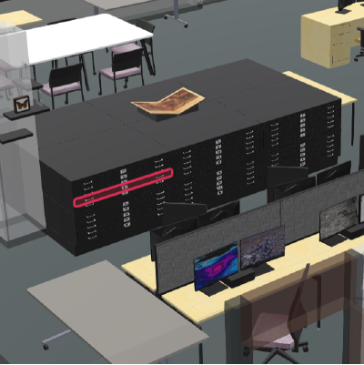
 Interactive Kiosk
VPOL Digital Scholarship Kiosk
A touchscreen exhibit for Michigan Tech's Van Pelt Library, surfacing student and faculty research through an interactive, map-driven interface.
 Story Map
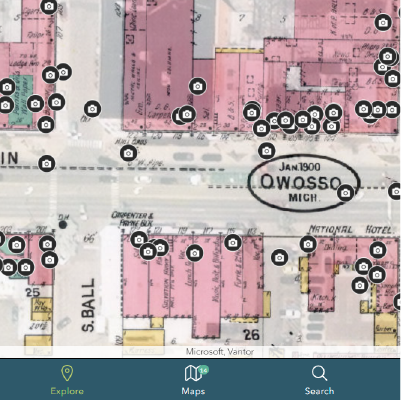
Owosso Time Traveler
A then-and-now story map pairing historic photographs of Owosso, Michigan with present-day street views, layered over archival plats.
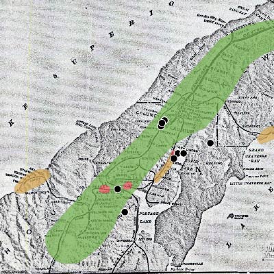
 Digital Atlas
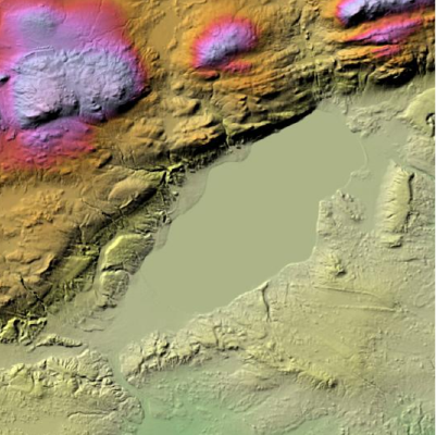
Keweenaw Geoheritage GeoAtlas
An interactive geologic atlas documenting the Keweenaw Peninsula's bedrock, mining heritage, and geoheritage sites for public and educational use.
 Building Explorer
Calumet Historic Building Explorer
A building-by-building survey of Calumet's National Historic Landmark District, linking footprints to ownership history and archival photos.
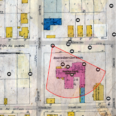 Image Catalog
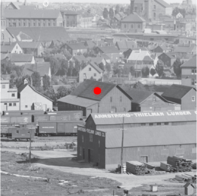
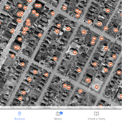
CCHI Spatial Image Catalog
A georeferenced catalog of historic photographs with mapped camera viewsheds, letting users see exactly where — and which direction — each image was taken.
 Archival Catalog
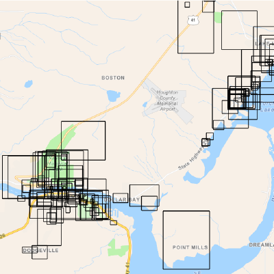
GRF Archival Map Catalog
A searchable, browsable catalog of historic maps from the GRF collection, with footprint overlays showing each map's real-world extent.
 Spatial Archaeology
Hamtramck Explorer
A neighborhood-scale explorer documenting the history and built environment of Hamtramck, Michigan through interactive map layers.
 Mobile Storytelling
Keweenaw Time Traveler: Mobile Storytelling
A location-aware mobile experience that delivers historic photos and stories as visitors move through the Keweenaw landscape.
 3D Explorer
Map & Geospatial Hub 3D Explorer
A 3D campus exploration tool built for Arizona State University's Map and Geospatial Hub, blending terrain visualization with wayfinding.
 Story Map
Where Francophones Worked in 1910
A interactive map to learn about the work environments that francophones encountered in the Keweenaw peninsula through historical maps and photographs.
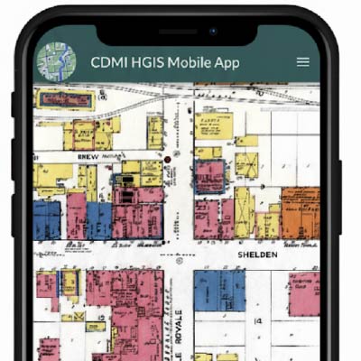 GIS Workshop
Building a Deep Mapping Mobile Application
An interactive workshop for the NEH Community Deep Mapping Institute where institute fellows create their own Deep Mapping Mobile Application.
 GIS Workshop
GIS for Humanities Workshop
A GIS workshop designed for Humanities students involving geocoding CSV files, interactive web mapping, and data visualization.
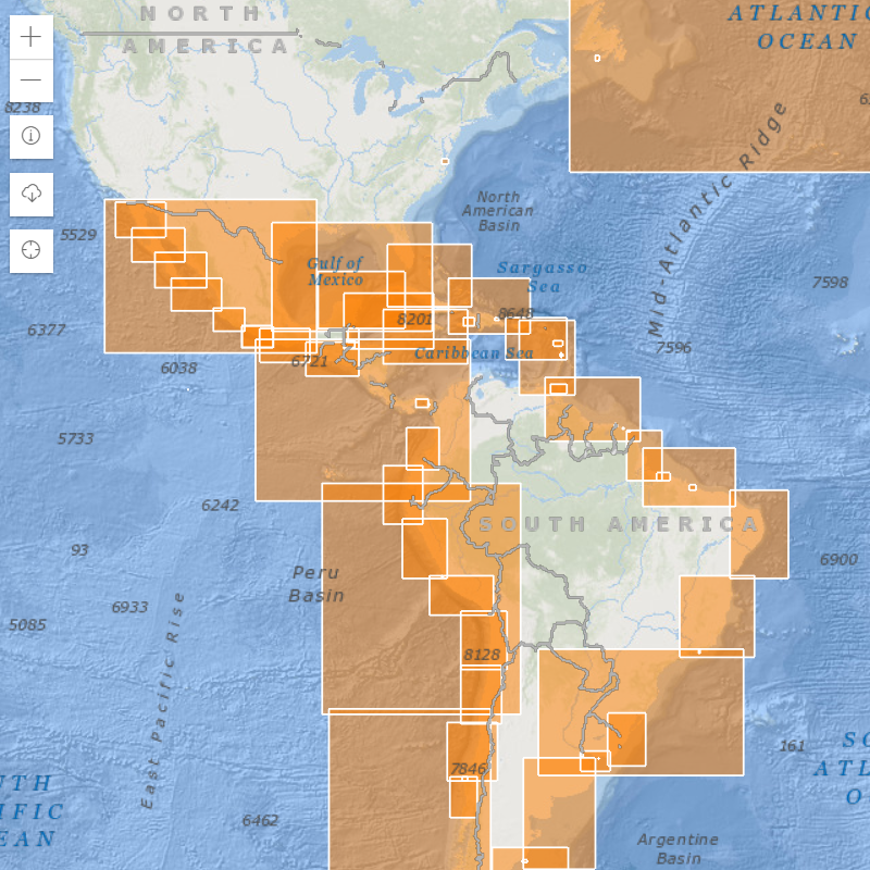 Chart Viewer
AGSL Nautical Charts Explorer
A digitized viewer for the American Geographical Society Library's historic nautical chart collection, georeferenced for direct comparison to modern coastlines.
 Sanborn Survey
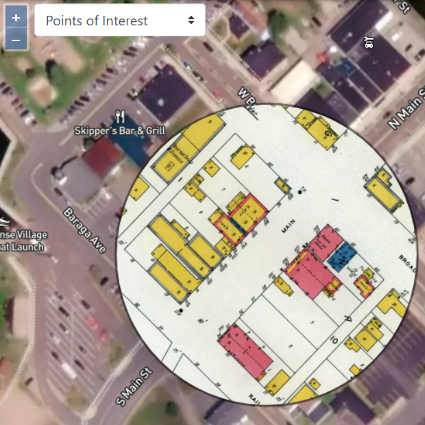
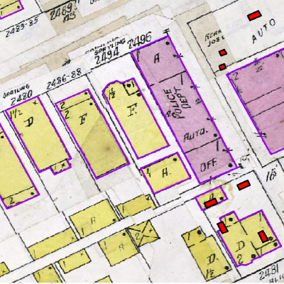
L'Anse 1938 Sanborn Maps
Georeferenced Sanborn fire insurance maps of L'Anse, Michigan from 1938, tiled for deep zoom and aligned to the current street grid.
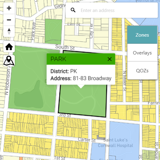 Zoning Map
Newburgh, NY Zoning Map
An interactive municipal zoning map for the City of Newburgh, built to make district boundaries and land-use rules easy to look up.
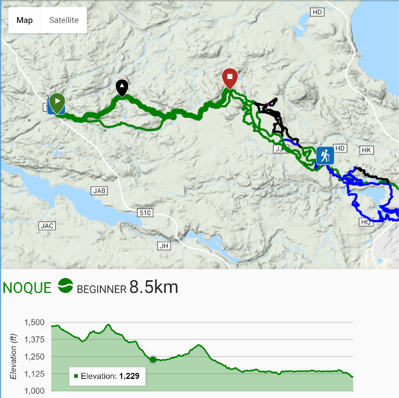 Trail Map
NTN Trails Application
A trail-finder for the North Country Trail network, with route conditions, mileage, and trailhead access mapped for planning trips.
 Maritime History
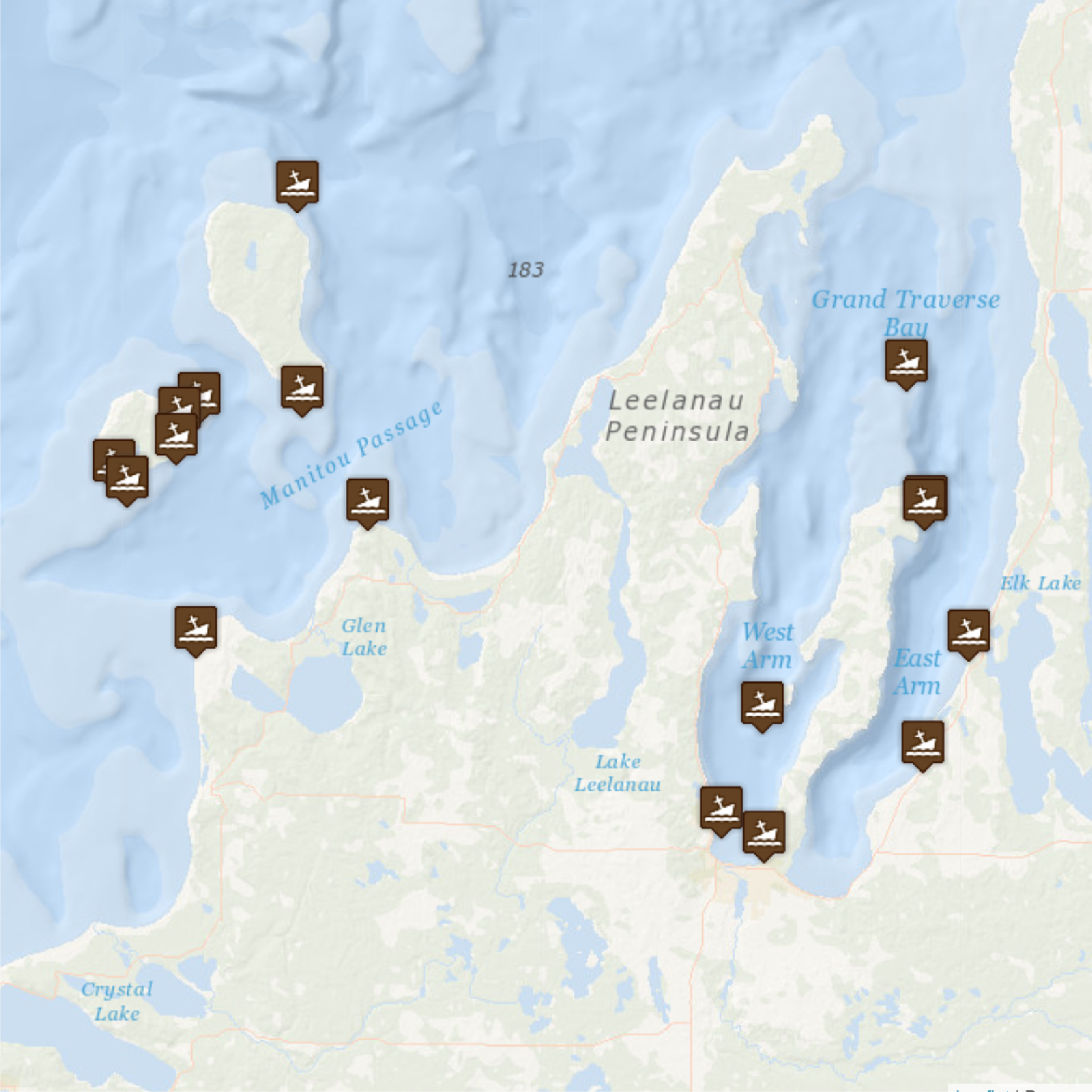
Lake Superior Shipwrecks
A mapped survey of known Lake Superior shipwreck sites, pairing coordinates with vessel histories and loss accounts.
 Brewery Locator
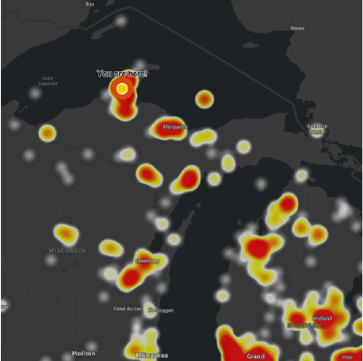
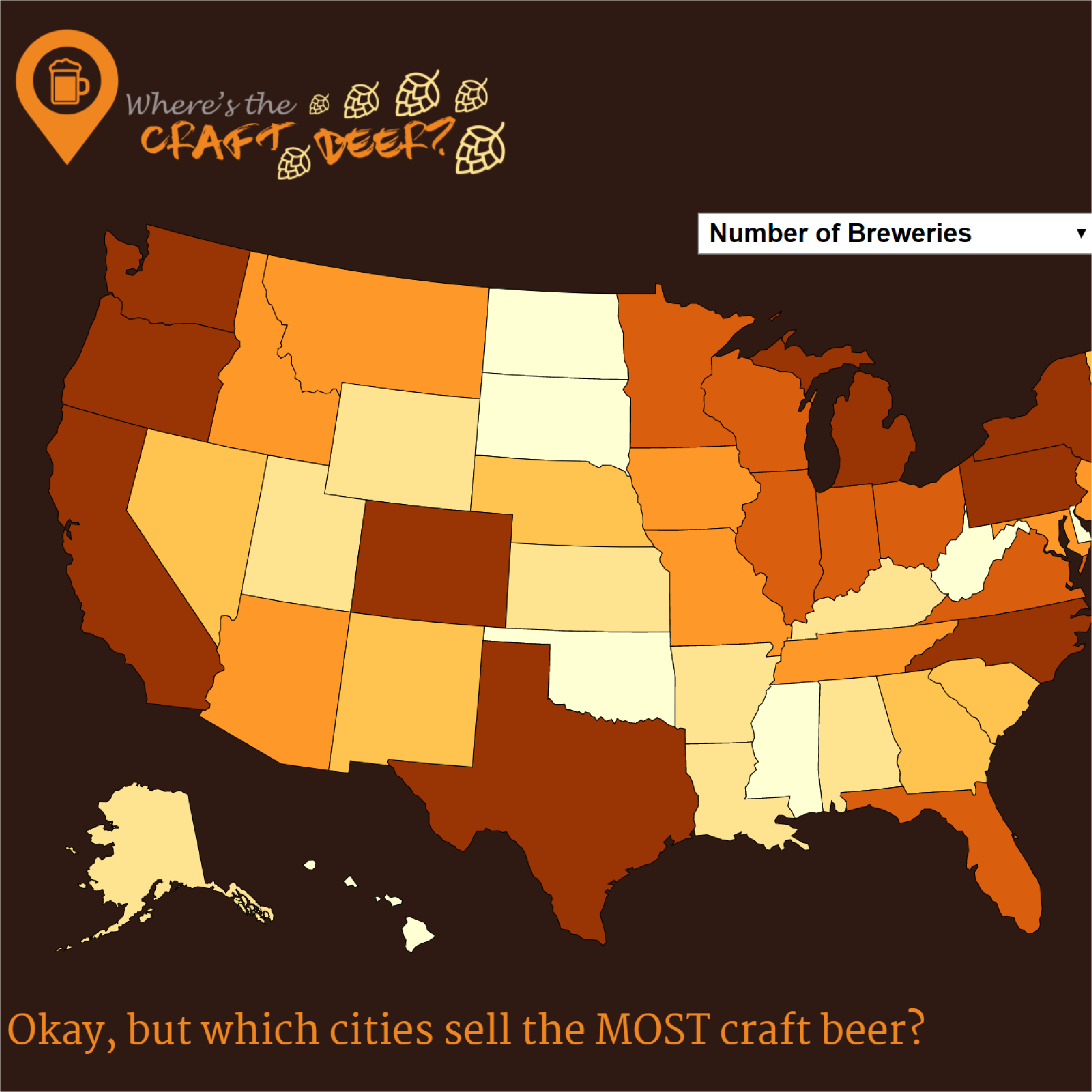
Where's the Craft Beer?
A lighthearted regional locator mapping craft breweries, built to explore point-data symbology and clustering at scale.
 Data Infographic
College Tuition Infographic
A data visualization tracking the rise of U.S. college tuition over time, designed to make a long trend legible at a glance.
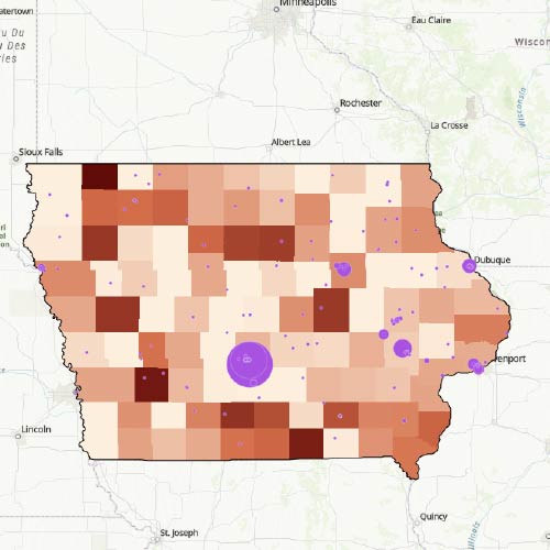
 Spatial Analysis
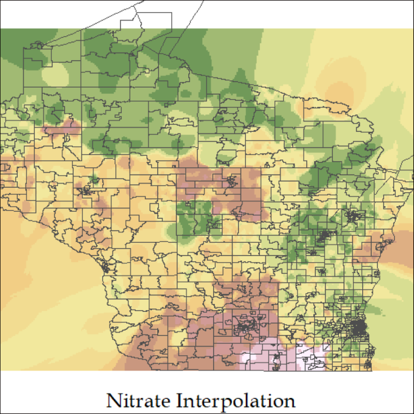
Spatial Analysis: Nitrate & Cancer Incidence
A Python-based geospatial analysis exploring correlation between groundwater nitrate levels and cancer incidence rates.
 Route Map
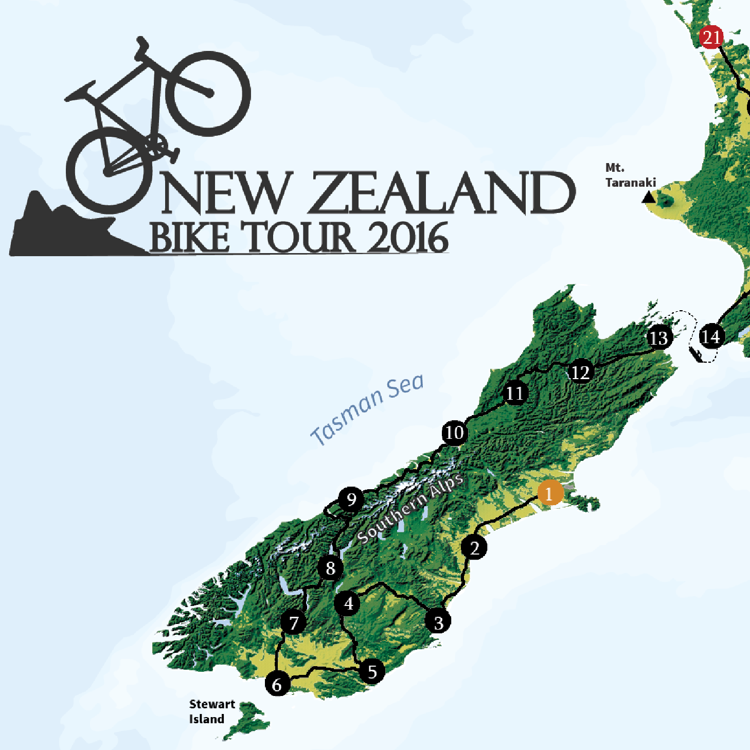
New Zealand Bike Tour
A route map and journal documenting a multi-week bicycle tour across New Zealand's North and South Islands.
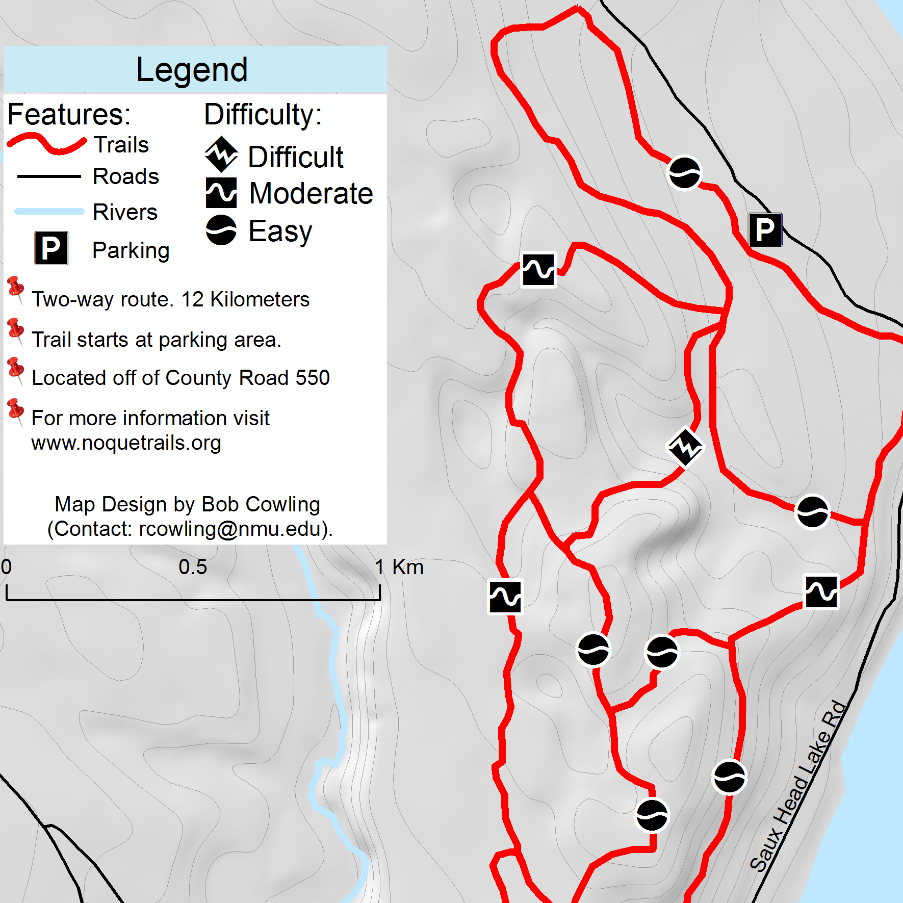 Ski Trail Map
Saux Head Ski Trails
A printable and web-ready trail map for the Saux Head ski area, showing groomed routes, difficulty, and elevation change.
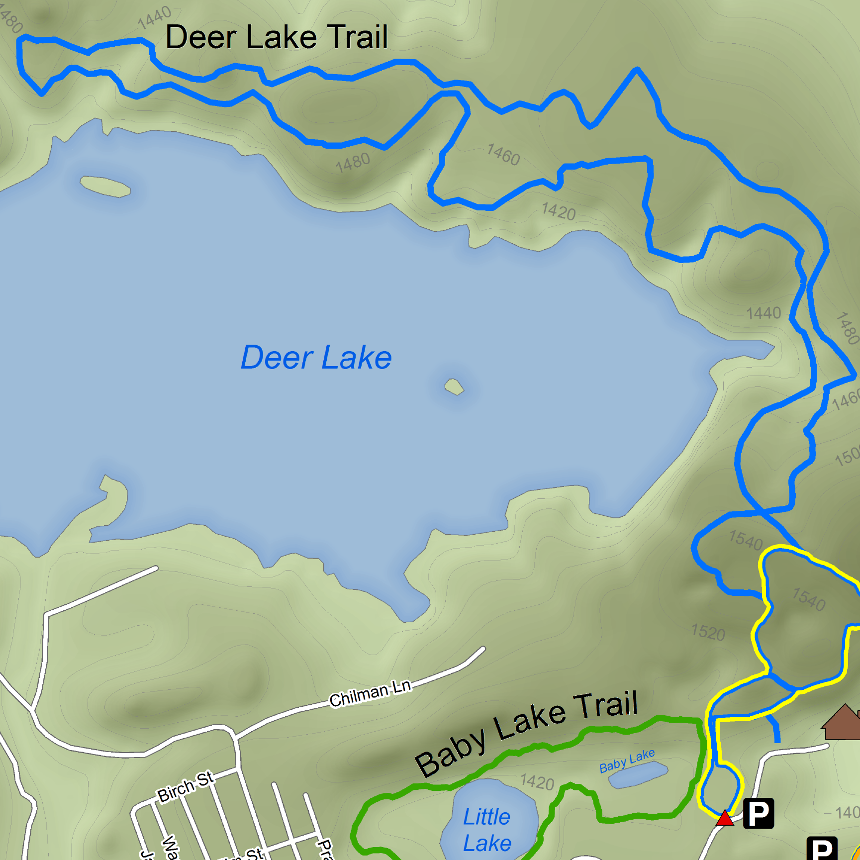 Recreation Map
Al Quaal Recreation Area
A recreation area map for Al Quaal in Ishpeming, Michigan, covering trail layout, facilities, and seasonal use.
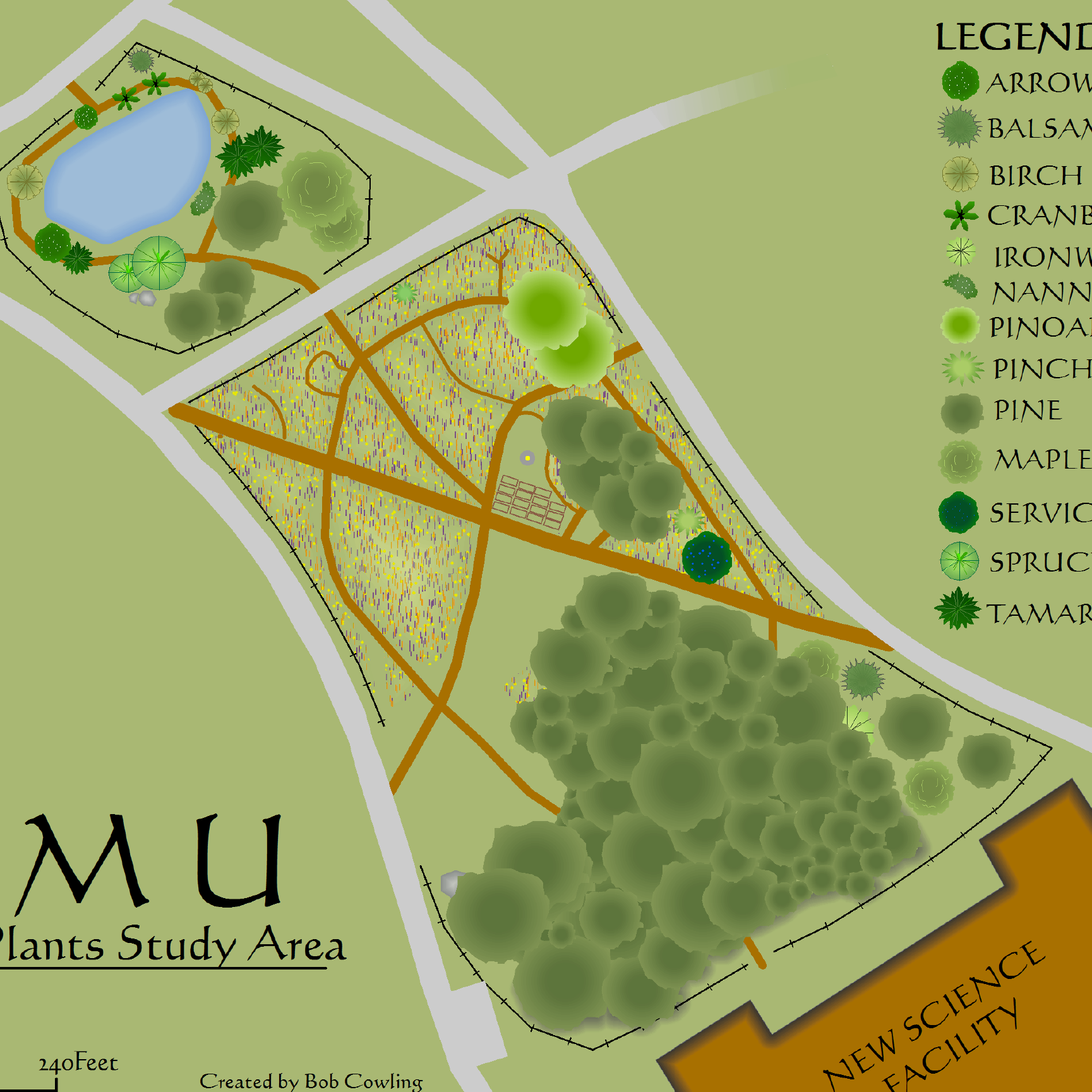 Native Plant Garden
NMU Native Plant Garden
An illustrated map of Northern Michigan University's outdoor learning area, identifying native plant species along a self-guided path.